Date: 28/11/2010
Area: Wicklow Mountains, Wicklow, Ireland
Maps used: OSI Sheet 56Weather: Clear skies for most of the route, no wind, very cold. Fresh snow, about 1/2 foot in places.
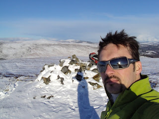
Route Description: This was a beautiful day in the 2010 / 2011 winter, which was one of the coldest in Ireland on record, with loads of snow falling across the country - especially in the mountains. A lot of fun, in other words. My initial idea was to climb Lugnaquilla, but when I got to the Military road junction on R755, the car just couldn't make it through the icy uphill bit. I had to park there and then and try something different, so Cullentragh and Mullacor seemed like a good option. Started from T140954, walking south along the road until it reaches a bridge and a sharp left turn. From there there's a track heading southwest which can be followed for a while, until eventually one heads a bit more westwards towards the top of Cullentragh. After reaching the summit (510m), headed directly west towards Mullacor (657m). Descended via the same route.
Duration: 5 hours
Distance: 11km
Total Ascent: 567m